Research

Global River Topology (GRIT)
At the University of Oxford, I developed a new global hydrography for river models and analyses. GRIT is a global river network that not only represents the tributary components of the global drainage network but also the distributary ones, including multi-thread rivers, canals and delta distributaries. It is also the first global hydrography (excluding Antarctica) produced at 30m raster resolution. It was created by merging Landsat-based river mask (GRWL) with elevation-generated streams to ensure a homogeneous drainage density outside of the river mask (rivers narrower than approx. 30m). Crucially, it uses a new 30m digital terrain model (FABDEM, based on TanDEM-X) that shows greater accuracy over the traditionally used SRTM derivatives. The work was picked up by various news outlets, was highlighted in EOS and featured in the University of Oxford Pulse news site. The dataset has over 50k downloads on Zenodo.
High-resolution, continental-scale hydrological modelling
As part of the Hydroclimatic Risk group at PIK, I lead the development of continental-scale applications of our high-resolution, eco-hydrological model SWIM. While the model is traditionally applied in single catchments, methods and datasets need to be developed to upscale the model to arbitrarily large domains. The overarching aim is to implement all catchment processes implemented in SWIM at regional scales without losing spatial detail. Model calibration is a major challenge, which I accomplish by employing multi-objective, evolutionary algorithms.
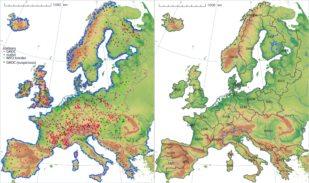
Physical and synthetic gauging stations built into the European model setup (left) and the catchment disaggregation of the model (right).
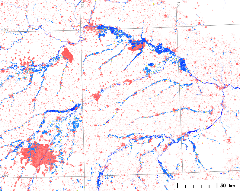
A 100-year flood zone (blue) with residential areas (red) in south-eastern Germany (bottom left is Munich) simulated by a stochastic CaMa-Flood model run.
Flood risk under climate change
River floods are one of the most detrimental natural catastrophes to human livelihoods and physical assets. I am working on building high-resolution, regional models that can quantify this risk for historical, current and future climatic conditions. I cooperate with various leading re/insurance companies to design and validate the models in research and operational settings. My main objective is to make flood risk modelling more transparent und future-proof by building on PIK's experience in climate impact research and modern, open-source technologies (such as OASIS-LMF).
Relevant publications: Hattermann, Wortmann et al. (2018), Wortmann et al. (2014)
Regional glaciohydrological modelling
During my PhD I integrated a glacier dynamics model into the semi-distributed model SWIM to enable climate change impact assessments of mountainous, highly glacierised catchments. The model enables an efficient representation of ice dynamics of individual glaciers at regional scales and assess changes in ice cover/volume and meltwater changes.
Relevant publications: Wortmann et al. (2018), Wortmann et al. (2019)
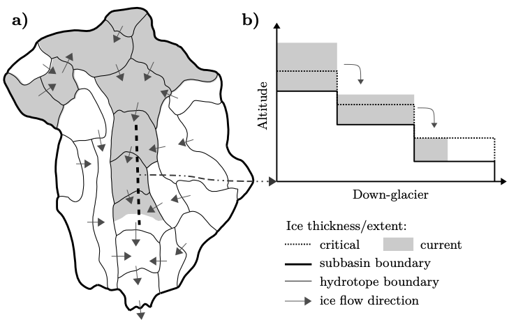
Glaciers are represented by a series of glacier response units to enable efficient ice routing inside and between subbasin (© Wortmann et al., 2019)